
Crockkinnagoe [Cnoc Chionn an Ghabha]
Good walks are even better shared.
Overview
Crockkinnagoe [Cnoc Chionn an Ghabha]
Nestled in the beautiful Sperrin Mountains of Northern Ireland, Crockkinnagoe stands proud at 540 meters, promising hikers a delightful blend of stunning scenery and a satisfying climb. The mountain's geological composition, predominantly granite and schist, unveils an ancient story of tectonic movements that shaped this remarkable landscape.
Routes
The Crockkinnagoe Circular Route is the most popular option, covering about 8.5 km and taking around 3.5 hours to complete. This route, while moderate in difficulty, rewards adventurers with captivating views and a rich encounter with nature. Just make sure to leave your mud-slinging shoes at home unless you're into that sort of thing!
Summit Features
At the summit, you'll find a majestic cairn made from local stone, perfect for catching a few rays while taking in the picturesque views or for executing your best mountain pose for the 'Gram.
Terrain
Prepare for rocky and grassy terrain with a good sprinkling of bog - grab those sturdy boots! The combination of glorious scenery and occasional squelchy patch makes for a truly immersive hiking experience.
Views
The summit dazzles with views stretching across the rolling Tyrone hills and, on clear days, even to the Atlantic Ocean! Don’t be surprised if you catch a sheep stuck in the frame of your perfect photo - they love to show off! The best seasons for these panoramic sights are spring and autumn, although summer has its perks too.
Hazards
As with any mountain hike, stay alert for slippery rocks and muddy patches, and be prepared for unpredictable weather changes! An umbrella may not be the most practical item to carry along, but extra layers definitely are.
Access
Part of the charm of Crockkinnagoe is how accessible it is. Park at the designated area near the H124724 grid reference. Unfortunately, public transport is a bit thin on the ground, so make sure you have your ride sorted. Draperstown is the closest town, about 10 km away, offering a few quaint cafes for that post-hike hot drink!
Facilities
Once you return from your conquest of Crockkinnagoe, you can refuel in Draperstown, where hospitality is as warm as the tea. Facilities may be sparse on the trail, so prep accordingly.
History
With the name Cnoc Chionn an Ghabha, meaning 'Hill of the Chief of the Fisherman', this mountain holds significant ties to local history and culture, offering a remarkable sense of place to its visitors. The Sperrin Mountains are steeped in folklore and agricultural traditions passed down the generations.
In conclusion, Crockkinnagoe is more than just a hike; it's a journey through rich landscape and local heritage. So lace up those boots, grab your walking stick, and get ready for an unforgettable adventure!
Explore routes near Crockkinnagoe [Cnoc Chionn an Ghabha]
Public walks starting within 80 km of this hill. Nearby does not mean a route reaches the summit; check its map and access before setting out.
Florence Court: Riverside and Forest Circuit, County Fermanagh
View route
Derry~Londonderry City Walls Circuit
View route
Banagher Glen and Forest: complete higher-return circuit
View route
Peatlands Park Red Trail: Annagarriff Wood and Derryadd Lough
View route
Route planning notes
These notes describe possible approaches, not verified navigable routes or permission to cross land. Check current paths, local access rules and conditions before setting out.
Crockkinnagoe Circular Route
A scenic loop starting and ending at the roadside, taking you through rugged terrain and delightful views.
Make a day of it, together
Find someone to share the walk with, or organise a day out along a route you like.
Hill facts and local notes
Classifications
Elevation
363m
1,191 ft
Prominence
212m
Coordinates
54.5997, -7.8089
H124724
OS Map
12
At the Summit
The summit boasts a prominent cairn made of local stones, which serves as an excellent photo opportunity - perfect for those 'look-at-me-on-a-mountain' selfies.
Terrain & Geology
Crockkinnagoe is primarily composed of granite and schist, characteristic of the Sperrins. The rocky outcrops offer insights into the geological history of the region, revealing ancient tectonic activity.
Views & Scenery
From the summit, you can enjoy breathtaking vistas of the Tyrone countryside, the distant Donegal mountains, and on a clear day, the Atlantic Ocean. Keep your eyes peeled for the odd sheep photobombing your view!
History & Heritage
Name Origin
Cnoc Chionn an Ghabha translates to 'Hill of the Chief of the Fisherman', highlighting the area’s historic connection to local fishing communities.
Historical Significance
The Sperrin Mountains, including Crockkinnagoe, have long been important to the local folklore and agriculture, with ancient connections to the communities that have inhabited this rocky terrain.
Getting There & Facilities
Check current local access restrictions, parking rules and transport timetables before travelling. These notes do not confirm public access to the summit.
Parking
Parking can be found at the H124724 grid reference, along the roadside, with space for a few vehicles.
Public Transport
Public transport options are limited; it’s advisable to travel by car. Local bus services run from nearby towns to the Sperrin area.
Nearby Facilities
Facilities are limited in the immediate area; however, Draperstown has a few cafes and pubs to refuel after your adventure.
Safety Information
Known Hazards
- Watch out for slippery rocks, muddy patches, and sudden weather changes. Always be prepared!
General Safety Tips
- Check weather conditions before setting out
- Carry appropriate clothing and equipment
- Let someone know your planned route
- Take a map, compass, and GPS device
- Carry emergency supplies: food, water, first aid kit, torch
Hills
Some common questions about the hills answered
Are there group walks up Crockkinnagoe [Cnoc Chionn an Ghabha]?
Many walkers use Walkmates to join or organise walks with others. You can check for group walks around Crockkinnagoe [Cnoc Chionn an Ghabha] through the maps
Are there other walkers around Crockkinnagoe [Cnoc Chionn an Ghabha]?
Activity varies by location and time, but Walkmates lets you see whether others have shared walks or shown interest in this area. Find other people through the walking friends search walking friends for Crockkinnagoe [Cnoc Chionn an Ghabha] search or of course create your own walk for Crockkinnagoe [Cnoc Chionn an Ghabha]
Can I organise a walk to Crockkinnagoe [Cnoc Chionn an Ghabha]?
Yes. If there aren’t any walks listed already, you can create a walk and make it available for others to join.
If you're signed up to Walkmates, you can create a walk to Crockkinnagoe [Cnoc Chionn an Ghabha].
How do I find a walk up this hill?
There are often multiple ways to walk this hill, depending on experience and route preference. Walkmates helps you explore walks and routes that others have shared.
Can I suggest a new route up Crockkinnagoe [Cnoc Chionn an Ghabha]?
Yes. You can suggest or create routes to share with others. Walkmates focuses on the social side of walking, so routes are used to help people organise walks and explore areas together, rather than as detailed navigation tools or route libraries.
Other uses really appreciate knowledgeable walkers sharing their routes. Share your favourite route to Crockkinnagoe [Cnoc Chionn an Ghabha] here
The is an error or something incorrect about this hill. How do I let you know?
We always strive to keep the information on Walkmates as accurate as possible. If you find an error, please let us know through the contact form and we'll aim to correct it as quickly as possible
Community Discussion
Comments
Location
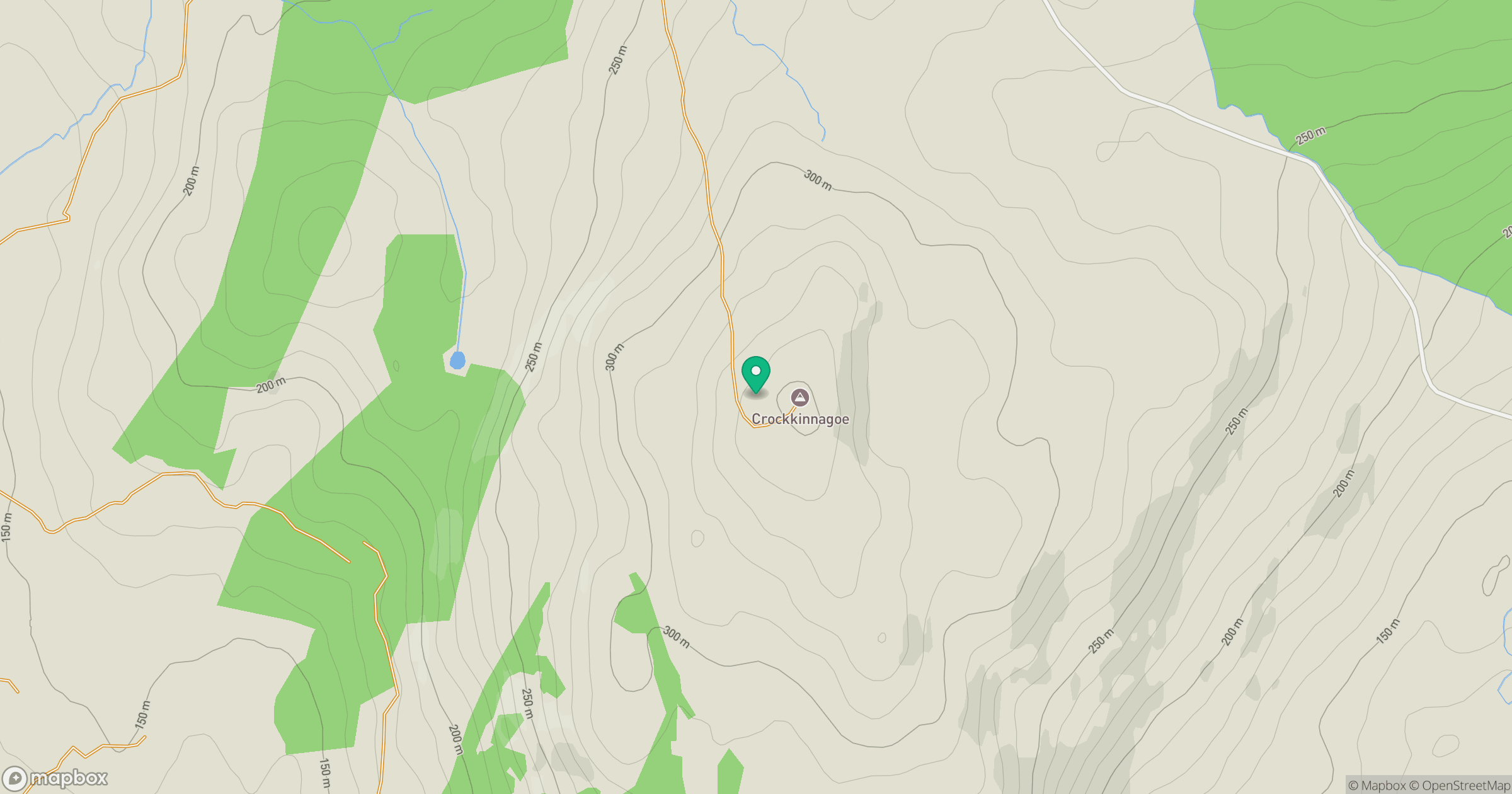
Grid reference: H124724
View on OpenStreetMapOpens a map in a new tab, centred on the hill.
Hills within 30 km
Straight-line distance, not a walking route or confirmation of access.
No comments yet. Be the first.